
Thursday, August 30, 2012
What's NOT for Dinner
Wednesday, August 29, 2012
Preparing For the John Muir Trail
Hiking the John Muir Trail was the easy part. Preparing for it took a lot of time and money. Having never backpacked more than 5 days before, we were both a little surprised by the scope of the logistics. We scoured the internet and hiking friends' brains. It paid off. We experienced very little trouble and we were well fed and comfortable most days. Tammie was down one day due to what we think was mild dehydration. She knew better, but got so busy enjoying the hike that she didn't keep track of her fluid consumption.
There are a multitude of choices when preparing for the hike, and our choices, are not by any means the best. But we thought we would add our two cents to the internet mix for the fun of it. Hope it helps someone.
Resupply Points: We sent a small resupply to Red's Meadow and ended up taking shuttle to Mammoth after all. Next time we might just plan on riding shuttle to Mammoth, cause it was fun. We sent 2 six gallon buckets of resupply to Muir Ranch. Ended up trading some food with other choices that were given to us from trail friends and other food available in the hikers leftover buckets. When we were there, Muir Trail Ranch had 25 five gallon buckets full of food and supplies that were leftover from others.
Conditioning: Starting in fall of 2011 we began walking at least 5 days a week. We began at about 2 flat miles and slowly grew from there up to the last month where we hiked 8 to 10 miles a day carrying a loaded pack up hills. We were glad we did as we had little to no pain on the trail. If we didn't have easy access to hiking in the mountains a stair master and a treadmill could suffice.
What we brought:
tip: Get a postage scale at any office supply and weigh everything. Make your choices with all the knowledge you can get.
Kelty External Back packs: We tried finding a new, lighter internal frame pack for the trip. But they just weren't as comfortable and cool as our 30 year old external packs that weighed in at 4 lbs 8 oz. We purchased new hip belts and shoulder belts (with load lifters) from Kelty for around 35 bucks for both packs. While we looked a little old fashioned, we loved the functionality of our packs and were never uncomfortable and had no problem hiking logs or hopping rocks. We saw many hikers with ultralight packs and while some loved them, others were obviously very uncomfortable. It appeared that if you go ultra light with a pack then you need to carry a very light load. Packing them 35 to 45 lbs is not what they were intended for.
tip: use a pack that you are comfortable with; try them out beforehand.
Western Mountaineering Down Bags: We replaced our 30 year old Camp 7 bags with these Cadilacs and loved them. They both weighed in at right over 2 lbs. Tammie had a Versalight with extra down in toe box, Mark had a Alpinlite with extra down in body.
Sleeping Pads: Ex Ped 1 lb air mats. Loved them and many hikers had them and loved them too. Heard no complaints. Super comfy when not over inflated. Next time we would also bring small piece of foam to sit on or put at our tent door.
Tent: We took a Big Agnes Flycreek 2 that weighed right under 3 pounds. We loved it until the weather turned ugly. Rain bounced in under the rainfly and due to the tent's narrowness it wicked through everywhere we touched. When we returned the Big Agnes to REI and told them the problems we had they said that a tent rated for 3 seasons is not the same as 10 years ago. They said we need a tent rated for 3 to 4 season.
tip: If you go with an ultralight model then you probably need to size up and in our case get one for 3 people so you won't ever touch the sides. Many single hikers loved Flycreek 2.
Trekking Poles: Tammie started with a pair purchased at Costco and they cracked on the trail. In Mammoth she replaced them with a Leki set and loved them. Mark used an old REI set.
tip: You usually get what you pay for.
Bear Canisters: Bear canisters are required on most of the JMT. We rented a Bearicade Expedition. Fantastic piece of equipment. If you let Wild Ideas know that you are doing a through hike they give you a set price, it was $55 this year, for however long you needed it. We also shipped a second Bear Vault, that we own, in our resupply to Muir Ranch. Not crazy about the Bear Vault. It is very difficult to open.
Boots: Tammie tried using New Balance trail runners during conditioning, but her feet got sore. She ended up with Keen Targue and added berry Super Feet insoles for more arch support. These boots were very common on the trail. (She had some difficulty finding a pair that didn't have defects in sizing and ended up taking scale to store and weighing each boot separately.) Initially Mark was using Targue's too for conditioning and loved them until the midsole broke down. Since he was planning on carrying more weight on the hike he opted for Asolo FSN 95 GTX hikers. He added orange Super Feet insoles.
tip: A podiatrist told us to buy boots 1/2 to 1 size bigger because your feet will swell walking all day. We did and were very happy.
Socks: Tried coolmax socks and Smartwools and the Smartwools in medium thickness won out for the hike. Tammie also wore liners and liked that the liners kept her socks cleaner and were easy to wash and dry. We each started the hike with 3 pairs of socks and eventually met a lady who needed socks, so we pared down to 2 pairs, and that was sufficient.
tip: We swapped out our socks every 2 to 4 hours to keep feet dry. We would hang one pair on pack to dry (if it wasn't raining) and wear the other. Protect your feet.
Hiking Clothes: We each opted for the lightest convertible pants we could find and long sleeve, quick drying, lightweight shirts. We rarely zipped off our pants. Pants saved on sunscreen and kept us cleaner. Loved our shirts. Mark wore a quick drying Mountain Hardware with netting on the sides. Tammie wore and lightweight Ex Officio. Again, we liked the long sleeve because it protected us from the sun. Next time we would add some type of lightweight fingerless gloves and then we wouldn't need sunscreen for hands either. Tammie wore a ball cap and Mark a cap with a flap to protect neck and ears from the sun.
tip: Lots of choices in hiking clothes and it really is just personal preference, just make sure you don't wear cotton as it doesn't insulate at all when wet.
Base Layer: We both brought 2 Ex Officio underwear; Mark's were boxer briefs and Tammie's were bikini cut. Tammie also brought an Ex Officio travel bra and a bikini swim top. The Ex Officio underwear are pricey, but we loved them. We could wash and wear again in a couple hours. We also brought microweight Smartwool tops and polypro bottoms. Next time we want wool for the bottoms as well. The wool didn't get stinky and wicked our sweat away better. Love Smartwool.
Rain Gear: Mark brought Dry Ducks lightweight raingear, and had no problem. The pants wore through on the bottom from sitting on granite, but a little duck tape fixed that. Tammie brought Sierra Designs Hurricane jacket and found that it was fine in light rain, but during long days of rain, she got wet. She brought her lightest Cabela rain pants and found that they weren't too waterproof either. In most years, on the JMT, they both would have been sufficient, but the end of our trip was unusually wet and cold. She will opt for better rain gear next time.
Other: Tammie brought a silk tank top and a mid-weight fleece and was thankful she had it when it got cold. Mark brought a down vest and tank top and never wore them. He sent tank top home from Muir Ranch. We both brought lightweight beanies and lightweight gloves and used them. We both had head torches and used them to read from the Kindle at night. Mark wore a watch with compass and altimeter. We had fun tracking our elevation. Each carried a small multi tool knife; Mark's was a light Leatherman and Tammie's was a tiny Swiss army knife. One tiny deck of cards for rousing games of gin rummy. Also brought 2 pack covers for rain protection, we were very glad we had them. Almost forgot, each of us brought a pair of slogger clogs for camp wear and creek crossings.
Toiletries: 1 roll of toilet paper, REI small quick dry towel, bandana, 3 oz. of sunscreen, 2.5 oz of Deet (didn't need it this year), 2 chap sticks with sunscreen, comb, ponytail holder, Diva Cup, travel sized toothpaste, 2 toothbrushes, 3 oz of Bronner's soap and a sea sponge for sponge baths. (In our Muir Ranch resupply we sent replacements of consumables. Needed TP and toothpaste, everything else we still had plenty.)
Water Containers: Mark brought a 2 liter Camelback and Tammie a 2 liter Platypus. Most often only carried 1/2 to 1 litre. Lots of water sources on JMT. Enjoyed having water hose to drink from easily all day, but sometimes it was difficult to know how much water was left. Might attach water bottles to shoulder pads next time, then we would have easy access and be able to see when we were running low. We also brought a super lightweight half litre water bottle, just the kind you buy bottled water in. We used this for drinking in our tent at night.
Thankfully the food weight fell by 3 to 4 lbs every day.
There are a multitude of choices when preparing for the hike, and our choices, are not by any means the best. But we thought we would add our two cents to the internet mix for the fun of it. Hope it helps someone.
Resupply Points: We sent a small resupply to Red's Meadow and ended up taking shuttle to Mammoth after all. Next time we might just plan on riding shuttle to Mammoth, cause it was fun. We sent 2 six gallon buckets of resupply to Muir Ranch. Ended up trading some food with other choices that were given to us from trail friends and other food available in the hikers leftover buckets. When we were there, Muir Trail Ranch had 25 five gallon buckets full of food and supplies that were leftover from others.
Conditioning: Starting in fall of 2011 we began walking at least 5 days a week. We began at about 2 flat miles and slowly grew from there up to the last month where we hiked 8 to 10 miles a day carrying a loaded pack up hills. We were glad we did as we had little to no pain on the trail. If we didn't have easy access to hiking in the mountains a stair master and a treadmill could suffice.
What we brought:
tip: Get a postage scale at any office supply and weigh everything. Make your choices with all the knowledge you can get.
Kelty External Back packs: We tried finding a new, lighter internal frame pack for the trip. But they just weren't as comfortable and cool as our 30 year old external packs that weighed in at 4 lbs 8 oz. We purchased new hip belts and shoulder belts (with load lifters) from Kelty for around 35 bucks for both packs. While we looked a little old fashioned, we loved the functionality of our packs and were never uncomfortable and had no problem hiking logs or hopping rocks. We saw many hikers with ultralight packs and while some loved them, others were obviously very uncomfortable. It appeared that if you go ultra light with a pack then you need to carry a very light load. Packing them 35 to 45 lbs is not what they were intended for.
tip: use a pack that you are comfortable with; try them out beforehand.
Western Mountaineering Down Bags: We replaced our 30 year old Camp 7 bags with these Cadilacs and loved them. They both weighed in at right over 2 lbs. Tammie had a Versalight with extra down in toe box, Mark had a Alpinlite with extra down in body.
Sleeping Pads: Ex Ped 1 lb air mats. Loved them and many hikers had them and loved them too. Heard no complaints. Super comfy when not over inflated. Next time we would also bring small piece of foam to sit on or put at our tent door.
Tent: We took a Big Agnes Flycreek 2 that weighed right under 3 pounds. We loved it until the weather turned ugly. Rain bounced in under the rainfly and due to the tent's narrowness it wicked through everywhere we touched. When we returned the Big Agnes to REI and told them the problems we had they said that a tent rated for 3 seasons is not the same as 10 years ago. They said we need a tent rated for 3 to 4 season.
tip: If you go with an ultralight model then you probably need to size up and in our case get one for 3 people so you won't ever touch the sides. Many single hikers loved Flycreek 2.
Trekking Poles: Tammie started with a pair purchased at Costco and they cracked on the trail. In Mammoth she replaced them with a Leki set and loved them. Mark used an old REI set.
tip: You usually get what you pay for.
Bear Canisters: Bear canisters are required on most of the JMT. We rented a Bearicade Expedition. Fantastic piece of equipment. If you let Wild Ideas know that you are doing a through hike they give you a set price, it was $55 this year, for however long you needed it. We also shipped a second Bear Vault, that we own, in our resupply to Muir Ranch. Not crazy about the Bear Vault. It is very difficult to open.
Boots: Tammie tried using New Balance trail runners during conditioning, but her feet got sore. She ended up with Keen Targue and added berry Super Feet insoles for more arch support. These boots were very common on the trail. (She had some difficulty finding a pair that didn't have defects in sizing and ended up taking scale to store and weighing each boot separately.) Initially Mark was using Targue's too for conditioning and loved them until the midsole broke down. Since he was planning on carrying more weight on the hike he opted for Asolo FSN 95 GTX hikers. He added orange Super Feet insoles.
tip: A podiatrist told us to buy boots 1/2 to 1 size bigger because your feet will swell walking all day. We did and were very happy.
Socks: Tried coolmax socks and Smartwools and the Smartwools in medium thickness won out for the hike. Tammie also wore liners and liked that the liners kept her socks cleaner and were easy to wash and dry. We each started the hike with 3 pairs of socks and eventually met a lady who needed socks, so we pared down to 2 pairs, and that was sufficient.
Hiking Clothes: We each opted for the lightest convertible pants we could find and long sleeve, quick drying, lightweight shirts. We rarely zipped off our pants. Pants saved on sunscreen and kept us cleaner. Loved our shirts. Mark wore a quick drying Mountain Hardware with netting on the sides. Tammie wore and lightweight Ex Officio. Again, we liked the long sleeve because it protected us from the sun. Next time we would add some type of lightweight fingerless gloves and then we wouldn't need sunscreen for hands either. Tammie wore a ball cap and Mark a cap with a flap to protect neck and ears from the sun.
tip: Lots of choices in hiking clothes and it really is just personal preference, just make sure you don't wear cotton as it doesn't insulate at all when wet.
Base Layer: We both brought 2 Ex Officio underwear; Mark's were boxer briefs and Tammie's were bikini cut. Tammie also brought an Ex Officio travel bra and a bikini swim top. The Ex Officio underwear are pricey, but we loved them. We could wash and wear again in a couple hours. We also brought microweight Smartwool tops and polypro bottoms. Next time we want wool for the bottoms as well. The wool didn't get stinky and wicked our sweat away better. Love Smartwool.
Rain Gear: Mark brought Dry Ducks lightweight raingear, and had no problem. The pants wore through on the bottom from sitting on granite, but a little duck tape fixed that. Tammie brought Sierra Designs Hurricane jacket and found that it was fine in light rain, but during long days of rain, she got wet. She brought her lightest Cabela rain pants and found that they weren't too waterproof either. In most years, on the JMT, they both would have been sufficient, but the end of our trip was unusually wet and cold. She will opt for better rain gear next time.
Other: Tammie brought a silk tank top and a mid-weight fleece and was thankful she had it when it got cold. Mark brought a down vest and tank top and never wore them. He sent tank top home from Muir Ranch. We both brought lightweight beanies and lightweight gloves and used them. We both had head torches and used them to read from the Kindle at night. Mark wore a watch with compass and altimeter. We had fun tracking our elevation. Each carried a small multi tool knife; Mark's was a light Leatherman and Tammie's was a tiny Swiss army knife. One tiny deck of cards for rousing games of gin rummy. Also brought 2 pack covers for rain protection, we were very glad we had them. Almost forgot, each of us brought a pair of slogger clogs for camp wear and creek crossings.
tip: Know yourself. Do you get cold or are you most often warm?
Toiletries: 1 roll of toilet paper, REI small quick dry towel, bandana, 3 oz. of sunscreen, 2.5 oz of Deet (didn't need it this year), 2 chap sticks with sunscreen, comb, ponytail holder, Diva Cup, travel sized toothpaste, 2 toothbrushes, 3 oz of Bronner's soap and a sea sponge for sponge baths. (In our Muir Ranch resupply we sent replacements of consumables. Needed TP and toothpaste, everything else we still had plenty.)
Mess Kit: We started hike with Steri- pen traveler and dropped and broke it. We replaced it with the lightweight Steri-pen Adventurer. Worked great, but it went through the batteries. Only did 20 or 30 litres on a set. Next time, we might opt for the new type water filter bags from Sawyer. We brought a Sumo Jetboil Stove and enjoyed the extra size for cooking meals, but could have got by on smaller jetboil pot. Large fuel canister lasted about 9 or 10 days and we boiled water 3 times a day. Brought back up small fuel canister, small foldable spatula, 2 plastic sporks, 2 Foster's beer cans converted to drinking and eating and sometimes cooking vessels. (took top off with can-opener and ziptied hotlips on so we didn't burn our lips, attached a plasic ring so we could hang on packs)
First Aid/Emergency: In a qt ziploc we put 4 esbit fuel tabs, dozen chlorine style water treatment tabs, 1 space blanket, storm matches from REI, Ace bandage, half dozen regular sized waterproof bandages, half a sports tape roll, some duct tape, about 4 large bandages, 6 Spenco second skin bandages, some Aleve, Exedrin, baby aspirin, Vicodin, Senna, Benedryl, Imodium, a couple of anti vomit pills too. Tammie also brought her vitamins and personal meds and tools for her lung condition. (In our resupply we sent a few more first aid supplies. We did not need them. We added some Super Glue that a trail friend gave us though and it was the best for attaching a bandage to Mark's blister.)
Fishing Supplies: We brought a 5 piece fly rod and a small collapsible spinning pole each with appropriate lightweight reels. Honestly could have caught fish with just a hand-line. We brought a couple dozen flies and a half dozen or so spinners and a couple bubblers for fly fishing with the spinning reel. We fished almost every day up until Muir Ranch. At Muir Ranch we sent home some of our heavier fishing stuff and only brought flies, pole and line. We didn't end up fishing on second half, as we just focused more on hiking. Not sure what we would do next time.
Water Containers: Mark brought a 2 liter Camelback and Tammie a 2 liter Platypus. Most often only carried 1/2 to 1 litre. Lots of water sources on JMT. Enjoyed having water hose to drink from easily all day, but sometimes it was difficult to know how much water was left. Might attach water bottles to shoulder pads next time, then we would have easy access and be able to see when we were running low. We also brought a super lightweight half litre water bottle, just the kind you buy bottled water in. We used this for drinking in our tent at night.
Food: Food prep is vital and took a lot of time before hand. Some hikers made the JMT their summer weight loss camp, but due to cold and wet weather this year, we heard a story of a woman who experienced 2nd degree hypothermia on Muir Pass. Bring sufficient food as it provides energy and warmth. A good rule of thumb is about 1.5 lbs to 2 lbs per person of high density, low volume food per day. Aim for an average of about 125 calories per ounce of food and between 3000 and 4000 calories a day per person.
Examples: We brought a couple cups of olive oil for every 10 days and added some to everything we cooked. Pro Bars and Justin's peanut butter packs were super dense foods that we were given at Muir Ranch from a trail friend. In the future we won't hike without them. For breakfast we had some fruit and nut packed oatmeal or some type of protein bar. We also repackaged Chicken Cup of Soups and added extra dehydrated vegis to them for our lunch as well as adding a little hot chilli or taco sauce packet to spice things up. For dinners we used mostly Mountain House dehydrated foods and added extra instant rice or instant mashed potatoes to the repackaged dinners in gallon ziplocs (otherwise the calories were insufficient for 2 people). Farmhouse's angel haired Parmesan pasta was good (with added dry milk, cremora and Parmesan packet). We also enjoyed dehydrated refried and black beans with added taco sauce packets. Small bagels were brought for first 2 legs of our journey and tortillas for the last section. Trail mix, corn nuts, jerky, snickers, jolly ranchers, and a variety of protein bars filled in during the day. We tried to snack on about 100 calories every hour we hiked. It kept our sugar levels from falling. We just carried some snacks in our shirt pockets and hiked while we snacked. We were really happy this way.
How much Weight we Carried:
We were obviously not ultralight hikers, but for us it worked. Leaving Tuolumne, Tammie's pack was at 23 lbs with a liter of water, (since Mark was able to carry all the food). She weighed her pack as she left Muir Ranch and it weighed in at 31 lbs with the Bear Vault full of food attached. (Some of their items had been sent home). Mark's base weight was 24 lbs with liter of water. When he left Tuolumne his pack weighed 41 lbs. and when he left Muir Ranch it weighed in at 47. (We don't have weights from leaving Red's Meadow). Thankfully the food weight fell by 3 to 4 lbs every day.
Tuesday, August 28, 2012
John Muir Trail: Tuolumne Meadows to Yosemite Valley
8-15-12
Tuolumne to Upper Cathedral lake
About 5 miles
Last night in Lone Pine we realized that the hike just didn't feel done and that since we had food left we might as well hike the section that we missed in the beginning. We have hiked that section in the past, but thought it would be fun to do it again via Cloud's Rest which we hadn't been on. Rode the Eastern Transit 6:15 AM bus to Bishop. Then one from Bishop to Mammoth and then on Yarts to Tuolumne. The buses all connected seamlessly. British John was on the Yarts bus and I found out why Mark visited all afternoon the previous day. It's the accent.... that and he has hiked all over the world. Interesting man.
We grabbed a permit from the same ranger station we had been at 3 weeks before and after stopping off at the grill for some lunch, we hit the trail. It felt good to be back in Yosemite. Love this place. Upper Cathedral lakes as lovely as always and we didn't have any rain. Clouds and a little thunder was all.
8-16-12
Upper Cathedral Lake to Happy Isles in Yosemite Valley (via Cloud's Rest)
About 21 miles
Met about 6 couples/groups that were starting their JMT hike. It was fun to encourage them and share our bit of trail lore. Incredible views from Cloud's Rest. Thankful that AJ had told us it was one of his favorite views on the whole trail. Loved hiking down into the valley that feels like home. We got married here 32 years ago and have camped and backpacked and hiked these trails our entire lives. Finally felt like a fitting ending to our wonderful hike. The day was probably over 15 miles of downhill, we were really thankful for strong knees and trekking poles. The trekking poles have been incredibly helpful. After having a man snap our photo at our finish we hopped on the shuttle to go get some pizza and beer.
Tuolumne to Upper Cathedral lake
About 5 miles
Last night in Lone Pine we realized that the hike just didn't feel done and that since we had food left we might as well hike the section that we missed in the beginning. We have hiked that section in the past, but thought it would be fun to do it again via Cloud's Rest which we hadn't been on. Rode the Eastern Transit 6:15 AM bus to Bishop. Then one from Bishop to Mammoth and then on Yarts to Tuolumne. The buses all connected seamlessly. British John was on the Yarts bus and I found out why Mark visited all afternoon the previous day. It's the accent.... that and he has hiked all over the world. Interesting man.
We grabbed a permit from the same ranger station we had been at 3 weeks before and after stopping off at the grill for some lunch, we hit the trail. It felt good to be back in Yosemite. Love this place. Upper Cathedral lakes as lovely as always and we didn't have any rain. Clouds and a little thunder was all.
 |
| Leaving the ranger station |
 |
| These little wandering asters were along the whole JMT |
 |
| Lovely Dome that I can't remember name of |
 |
| Cathedral Peak |
 | |
| Upper Cathedral Lake (check out the face) |
8-16-12
Upper Cathedral Lake to Happy Isles in Yosemite Valley (via Cloud's Rest)
About 21 miles
Met about 6 couples/groups that were starting their JMT hike. It was fun to encourage them and share our bit of trail lore. Incredible views from Cloud's Rest. Thankful that AJ had told us it was one of his favorite views on the whole trail. Loved hiking down into the valley that feels like home. We got married here 32 years ago and have camped and backpacked and hiked these trails our entire lives. Finally felt like a fitting ending to our wonderful hike. The day was probably over 15 miles of downhill, we were really thankful for strong knees and trekking poles. The trekking poles have been incredibly helpful. After having a man snap our photo at our finish we hopped on the shuttle to go get some pizza and beer.
 |
| Walking the ridge to the top |
 |
| Looking east |
 |
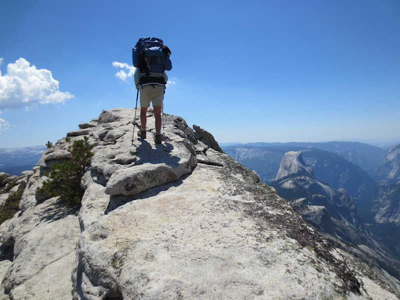
| Top of Cloud's Rest |
 |
| Half Dome |
 |
| Nevada Falls |
 |
| The END |
Monday, August 27, 2012
John Muir Trail: Twin Lakes area to Mount Whitney
8-9-12
Pond above Twin Lakes to 2nd Creek above Wood's Crossing
Approximately 6 miles
Bad Day. Couldn't make our planned camping destination. I woke up very tired and never improved. Hiking down along rocky, but beautiful Wood's creek (with marble swimming holes) was doable, but after we crossed the suspension bridge and headed up it was another story. I began staggering and then my stomach started cramping. Tears soon followed and I wondered how I got so weak. We stopped at 2nd small stream that crossed the trail, and Mark threw up the tent. I slept most of the afternoon, while Mark tended a small fire under a steady drizzle of rain. I woke up to small offerings outside our tent from concerned trail friends that had passed by, probably won't see them again.
 |
| The Pond we camped at. |
 |
| Wood's Creek Waterfall |
 |
| Pack String |
 |
| Suspension bridge over Wood's Creek |
8-10-12
Creek to Upper Rae Lake
Approximately 4 miles
Beautiful, bright sunny morning hike to Upper Rae Lake. Got there around 11 am and visited with Ben and Jessica that we had met in Mammoth. They were running short on fuel for their jet boil, so we gave them our spare. His sister was meeting them at nearby Kearsage pass with a resupply, so they are going to leave us some electrolytes and coffee at a bear box in Vidette Meadow. Yay. We lost our electrolytes somewhere after Mather and we drank more coffee than I had rationed for. Gotta have my coffee. About noon the thunder began and then rain. Made the decision to stay on this side of pass. We popped our tent up and spent a long, long, long afternoon sleeping, playing gin rummy and reading on the kindle. Rain, sleet and thunder stopped at 6:30 and we had tea and dinner. Rae Lakes are spectacular. Painted mountains all around, deep blue crystal clear water and many fish jumping. We hope I am completely back to speed tomorrow. Oh, yea, cut my thumb today and got to use steri strips. Some people just shouldn't handle knives.
All of the following photos are Rae Lakes:
 |
| Looking south at lunch |
 |
| Looking north at lunch |
 |
| Weird light during storm |
 |
| Dinnertime! |
8-11-12
About 10 miles
Rae Lake to Center Basin Creek
Wonderful day. Up and over Glen Pass in an hour and a half including time spent scanning for big horn sheep. Didn't see any, but it sure did help our breathing. Had our tent up by 2:30, right before the afternoon thunderstorm. Much smaller storm today. The canyon we hiked today is lovely. Nice change. Creek's gurgled, bird's sang, flower's smiled and the pine tree's waved. Mid-day we stopped in Vidette Meadow area and got the coffee and electrolytes that Ben and Jessica left us and dried all of our gear that was still a bit damp from yesterday. Had a dip in the creek. Nervous about Forester Pass tomorrow.
 |
| Glen Pass |
 |
| Smiling Flower |
 |
| Only saw these flowers this one time |
 |
| View up the canyon towards Forester Pass |
8-12-12
About 18 miles
Center Basin Creek to Crab Tree Ranger Station
Exhilarating day. Forester may be tall at over 13,000 feet, but the trail from the north is so evenly graded that it was a walk in the park. Sang praise songs to our maker as we hiked. Glorious. We got our photo snapped on top by a Latino young man from LA who is part of some Society of Outdoorsmen. He had a crazy twirling mustache. The switchbacks on the other side were steep and we flew down them like we had wings. The open plain below is dotted with tarns and all at 12,000 feet. Weird to be so high and yet everything was basically flat. The Outdoorsmen passed us as it started to lightly rain and we put on our rain jackets and pack covers and then it hailed like crazy! We should have put on our rain pants too as we were soaked and freezing in what seemed like seconds. Took off walking fast as possible to stay warm and I kept shoving trail mix in my mouth to heat up from the inside. Eventually, found some tree and rock cover and pulled off wet bottoms and put on rain pants. Rained and misted all day and we kept hiking to stay warm. Big horn plateau is striking, we would have loved to have had time to enjoy it, but as it was, we raced across due to lightening. Met Lonnie and her dad by Wallace Creek. Lonnie has hiked over 180 miles in her flip flops as she got blisters from her shoes. She is one tough 16 year old. We thought of making Guitar Lakes today and meet up with trail friends, but I pooped out at Crabtree. We are almost done. Top of Whitney is only about 7 miles away and 4000 feet up. Tomorrow we will dry our gear, rest and make short move to Guitar Lake.
 |
| Up Forester |
 |
| Forester Pass |
 |
| Big Horn Plateau |
 |
| Cold and wet, but still smiling |
 |
| Lonnie's feet |
 |
| Meet and Greet Mules |
 |
| Sunset at Crabtree |
8-13-12
Crabtree to little pond above Guitar Lake
Approximately 2.7 miles
Leisurly morning drying all our gear. Discovered this toilet near our tent. Weird sight. Visited with Ranger and he suggested we plan on summitting Whitney early to avoid thunderstorm activity. Hiked to small, pretty lake about Guitar in freezing rain. Had the place to ourselves until 4 guys arrived. They had come in from the south to climb Whitney. I was a little bummed with neighbors until they brought out all their food and drink! Wow. Wonderful stuff they shared and discovered they were super sweet too. Later John, an older gentleman from the UK, arrived and Mark chatted with him all afternoon until sunset while I stayed in tent eating to warm myself up, as I am having some problems keeping feet and hands from freezing, even with 2 pairs of gloves and 2 pairs of socks. Tomorrow is the big day. Blessed with a gorgeous sunset tonight.
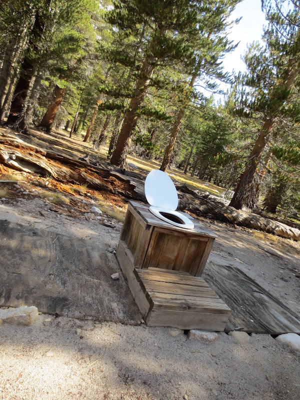 |
| Do bears poop in the woods? |
 |
| Clothes tree |
 |
| Guitar Lake |
 |
| Our tent and a gorgeous sunset |
Approximately 16 miles
Pond above Guitar Lake to Whitney Portal
Felt like God woke me at around 1:30, urging me to wake Mark up and leave. Hiking by the light of our head torches was a new experience. It almost felt easier because only a few steps ahead were lit. ( object lesson: Maybe it is good we don't know the future either). About an hour or so into the hike we saw a long Congo line of lights chasing us up the switch-backed trail. Kind of surreal. At one point we thought we had lost the trail and we stopped. Luckily, a couple from the Whitney Portal side soon arrived and led the way, as they had been on it before. About 20 minutes before sunrise we arrived at the summit. There were only 6 of us for the first glow and then the kid with the crazy mustache showed up. It was good to see him and he took our photo again. Watching the sun rise felt the beginning of creation from the top of the world.
We were all bundled up and still in awe when this young couple arrived wearing only Lycra running gear. They announced that they were going for the JMT record and would be in Yosemite Valley in 72 hours; crazy, and impressive.
It was a long, long hike down through a maze of people attempting Whitney from the Portal side. It didn't look like the altitude was agreeing with them. We were glad we were so acclimatized. Did meet Steve and Kathy from Muir Ranch. Apparently they had been slightly behind us the whole way and the day we were stuck in the tent at Rae Lake they were just across the lake from us enjoying hot cocoa under a big tarp that the Sierra Club put up. If only we'd know.
About 1:00 a light shower fell, but it only made the canyon lovelier. By 2:00 we were having burgers at the Portal and by 3:30 we got a ride by the couple who had guided us in the dark. Arriving in Lone Pine 13 miles later we were shocked by the 100 plus degree heat and quickly got a room at the hostel. Hard to believe that we had been so cold earlier that day.
 |
| Pre-dawn glow |
 |
| Nearing the hut on top |
 |
| The marker |
 |
| Sunrise on top of highest point in contiguous U.S.! |
 |
| View to the northwest ( I think) |
 |
| View to the southwest (I think) |
 |
| Along the way |
 |
| The trail looked narrower by day |
 |
| Approaching Trails Crest and our backpacks that we left there |
 |
| Along the way |
 |
| Lovely water fall near Whitney Portal |
Sunday, August 26, 2012
John Muir Trail: Muir Trail Ranch To South of Pinchot Pass
8-5-12
Muir Ranch to Darwin Creek
Approximately 14 miles
Had last breakfast at the ranch, made up our sack lunch at were heading up the trail by 8:15. I felt much heavier with a bear canister full of food and really wondered if I could do this next 111 mile section. Started off easy, but leaving the South Fork of San Joaquin River was steep and slow. Embarrassingly slow. We met this guy who forgot his camera at the river though, so he had to climb it TWICE. Lots of pretty cascades to look at as we climbed and once we got to Evolution Valley it was easier, not flat mind you, but easier. Met a lady from Colorado who was camping after being packed in with horses. She really made me feel like a rock star and I was encouraged. Did our first actual creek crossing. It was only calf deep, but we still had to take our shoes off. We swam a few times in the creek throughout the day sharing the pools with fly fisherman. Beautiful sunset lighting up the surrounding granite.
8-6-12
Darwin Creek to Little Pete Meadow
Approximately 15 miles
Amazing hike over Muir Pass. Evolution Basin incredible; desolate, wild and beautiful. Talked with the camera guy and his friend from yesterday, they are from New Jersey. Really nice. Had a two older hikers zero in on us to talk. It was kind of weird, but we got some advice, "don't do Golden Staircase in heat of day!". Finally, got to top of pass and Muir hut stood sturdy and Mark had another glacier frosty. Hike down was rocky and hard to follow and we are now footsore for first time. Worst section of trail yet. Very long day. Father and son team, Fred and AJ, are camping with us tonight. Interesting people and strong hikers as they are also climbing many peaks along the trail. Found out boys from Jersey are named Jeff and Chris. One big family on the JMT.
8-7-12
Little Pete Meadow to Lower Palisades Lake
Approximately 11 miles
Hiked 7 lovely miles to Deer Meadow at base of Golden Staircase. We did laundry, ate, rested and visited with the Jersey Boys who stopped also. About 5:00 we headed up the Golden Staircase under some clouds that turned to rain that brought in thunder. It was a little intense, but an amazing 1800 foot climb. The rocks were hot, but the air was cool. No problems. Thanks old guy who gave us the advice. Weather cleared at lake and we were going to hike higher, but met this old sour dough, with not many teeth, and he told us there wasn't any camping higher. "All filled up." I'm starting to think these old guys are angels in disguise! Set up tent and just as it was getting dark the Jersey Boys showed up.
8-8-12
Lower Palisades Lake to small tarn near Twin Lakes
Approximately 18 miles
Two 12,000 foot passes today and a varied terrain. Mather pass was steep with amazing views. To the north you had alpine lakes surrounded by rock quarries and to the south was a wide rolling valley surrounded by craggy mountains in various shades of browns and reds. Hiking through the broad valley was magical. We crossed streams and in one I had a cool shower. We gave some young men going the other way some snicker bars and sent a bag of peanut m&m's back the trail to the Jersey Boys. Wondered why they hadn't passed us yet and found out from some other hikers that Jeff had forgot his camera on Mather and had to go back! We see a pattern here. :-) Crossed Kings River and for the fun of it decided to go for Pinchot Pass 4 miles away. At about 5:00 we met up with Fred and AJ camping at Marjory lake and shared some more candy bars and then took off for the nearby pass. It was an easy pass as far as passes go. The terrain was a nearly barren, rocky landscape with small, tiny plants. One wonders how they survive. The lakes in this area were strangely blue. Looked alien. By 6:00 we were on top and discovered there wasn't any nearby water on the other side. OOPS. Hiked to first little pond with campsites and enjoyed a dinner by sunset and then collapsed in bed. It looks a bit like the southwest here.
Muir Ranch to Darwin Creek
Approximately 14 miles
Had last breakfast at the ranch, made up our sack lunch at were heading up the trail by 8:15. I felt much heavier with a bear canister full of food and really wondered if I could do this next 111 mile section. Started off easy, but leaving the South Fork of San Joaquin River was steep and slow. Embarrassingly slow. We met this guy who forgot his camera at the river though, so he had to climb it TWICE. Lots of pretty cascades to look at as we climbed and once we got to Evolution Valley it was easier, not flat mind you, but easier. Met a lady from Colorado who was camping after being packed in with horses. She really made me feel like a rock star and I was encouraged. Did our first actual creek crossing. It was only calf deep, but we still had to take our shoes off. We swam a few times in the creek throughout the day sharing the pools with fly fisherman. Beautiful sunset lighting up the surrounding granite.
 |
| Stately pines |
 |
| Looking back down San Joaquin drainage |
 |
| One of many cascades along Evolution Creek |
 |
| Evolution Valley/ McClure Meadow |
Darwin Creek to Little Pete Meadow
Approximately 15 miles
Amazing hike over Muir Pass. Evolution Basin incredible; desolate, wild and beautiful. Talked with the camera guy and his friend from yesterday, they are from New Jersey. Really nice. Had a two older hikers zero in on us to talk. It was kind of weird, but we got some advice, "don't do Golden Staircase in heat of day!". Finally, got to top of pass and Muir hut stood sturdy and Mark had another glacier frosty. Hike down was rocky and hard to follow and we are now footsore for first time. Worst section of trail yet. Very long day. Father and son team, Fred and AJ, are camping with us tonight. Interesting people and strong hikers as they are also climbing many peaks along the trail. Found out boys from Jersey are named Jeff and Chris. One big family on the JMT.
 |
| Evolution Lake |
 |
| Mark on diving board in Evolution Basin |
 |
| Muir Hut and Mark |
 |
| Long hike down |
8-7-12
Little Pete Meadow to Lower Palisades Lake
Approximately 11 miles
Hiked 7 lovely miles to Deer Meadow at base of Golden Staircase. We did laundry, ate, rested and visited with the Jersey Boys who stopped also. About 5:00 we headed up the Golden Staircase under some clouds that turned to rain that brought in thunder. It was a little intense, but an amazing 1800 foot climb. The rocks were hot, but the air was cool. No problems. Thanks old guy who gave us the advice. Weather cleared at lake and we were going to hike higher, but met this old sour dough, with not many teeth, and he told us there wasn't any camping higher. "All filled up." I'm starting to think these old guys are angels in disguise! Set up tent and just as it was getting dark the Jersey Boys showed up.
 |
| Granite walls of La Conte Canyon |
 |
| Lovely spot along the way |
 |
| Going up the Golden Staircase |
 | |
| Lower Palisades Lake with small sunset glow |
8-8-12
Lower Palisades Lake to small tarn near Twin Lakes
Approximately 18 miles
Two 12,000 foot passes today and a varied terrain. Mather pass was steep with amazing views. To the north you had alpine lakes surrounded by rock quarries and to the south was a wide rolling valley surrounded by craggy mountains in various shades of browns and reds. Hiking through the broad valley was magical. We crossed streams and in one I had a cool shower. We gave some young men going the other way some snicker bars and sent a bag of peanut m&m's back the trail to the Jersey Boys. Wondered why they hadn't passed us yet and found out from some other hikers that Jeff had forgot his camera on Mather and had to go back! We see a pattern here. :-) Crossed Kings River and for the fun of it decided to go for Pinchot Pass 4 miles away. At about 5:00 we met up with Fred and AJ camping at Marjory lake and shared some more candy bars and then took off for the nearby pass. It was an easy pass as far as passes go. The terrain was a nearly barren, rocky landscape with small, tiny plants. One wonders how they survive. The lakes in this area were strangely blue. Looked alien. By 6:00 we were on top and discovered there wasn't any nearby water on the other side. OOPS. Hiked to first little pond with campsites and enjoyed a dinner by sunset and then collapsed in bed. It looks a bit like the southwest here.
 |
| Mather Pass looking south |
 |
| Mather Pass looking north |
 |
| Shower time |
 |
| Looking back at Mather Pass midday |
 |
| Alien landscape |
 |
| Pinchot Pass |
 |
| Sunset at camp |
Subscribe to:
Posts (Atom)